
Rover Geonics EM34-3XL Surveys
The Geonics EM34-3XL ground conductivity meter can be applied in ‘rover-mode’ for high resolution coverage in a short amount of time. The onboard ‘Archer2‘ datalogger collects real-time GPS at 1-second intervals tagged to Apparent Conductivity readings at 5x per second.
The low-stretch tow-strap keeps the distance between the receiver and transmitter sleighs close to the optimum ‘nulled’ 20-metre separation.
The same specially configured plastic sleighs with no metallic components used for the IMAGEM rover surveys are also used here – allowing for stable coverage.
The mode of operation in the case displayed here is ‘vertical dipoles, 20-metre Tx-Rx separation’ for effective depth penetration of 30 metres.
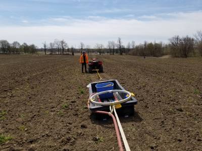
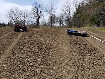
EM34 Transmitter Coil sleigh +15m layback from ATV to transmitter sleigh and coil
A Geonics EM31 survey is typically also completed for shallower depth coverage up to ~6 metres.
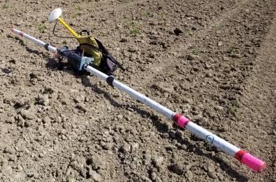
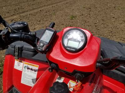
EM31 with Trimble and DAP logger Garmin mounted on ATV console
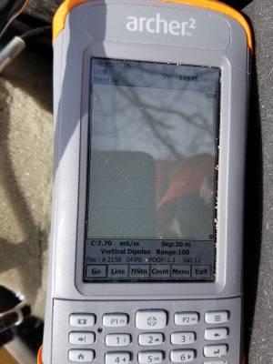
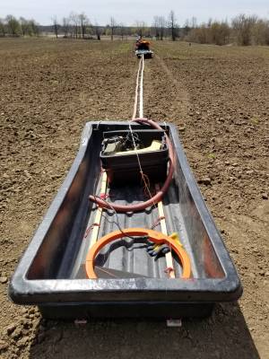
EM34 datalogger Receiver Coil sleigh
In-house software CVNAV is used to correct the plotting position to half-way between the transmitter and receiver. A 1-second latency correction to account for GPS positioning versus reading is also applied. This software is the same as used for all Cesium Mag and other DGPS Rover Surveys. Other instruments such as GPR (ground penetrating radar) can also be towed so that large areas can be examined quickly and efficiently. State-of-the-art software is used to process and present the large volumes of geophysical data.